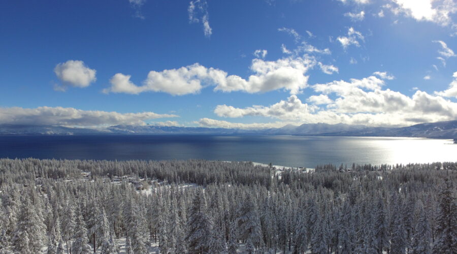
Drone Footage: Lake Tahoe’s 17% Snowpack From Above
Drone footage has an unparalleled ability to transform the familiar into the extraordinary. When the lens ascends above Lake Tahoe, it doesn’t just capture water and sky—it reveals the intricate choreography of nature’s seasonal shifts. The 17% snowpack, a figure that might seem abstract from the ground, becomes a striking visual narrative when viewed from above. This aerial perspective doesn’t just document; it invites contemplation of the delicate balance between human perception and environmental reality.
The Illusion of Stillness: Snowpack as a Fragile Canvas
From the shore, Lake Tahoe’s snowpack appears as a static blanket, a quiet testament to winter’s persistence. Yet, from the air, it is anything but static. The 17% measurement—far below historical averages—unfolds as a mosaic of exposed granite, skeletal trees, and patches of snow clinging to north-facing slopes like remnants of a retreating tide. The drone’s perspective strips away the illusion of permanence, exposing the transient nature of snow as a finite resource. This isn’t just a visual shift; it’s a cognitive one, forcing observers to reconcile the serene surface with the underlying fragility.
The Paradox of Clarity: Depth in a Two-Dimensional Frame
Aerial footage often simplifies complex landscapes into bold, contrasting hues. At Lake Tahoe, the 17% snowpack becomes a stark counterpoint to the deep blues of the lake and the earthy tones of the surrounding Sierra Nevada. Yet, within this simplicity lies a paradox: the more straightforward the image, the more it demands interpretation. The absence of snow doesn’t just highlight the drought—it underscores the interconnectedness of the ecosystem. The drone’s unblinking eye captures not just the snow’s retreat but the subtle shifts in vegetation, the exposed shorelines, and the way light fractures across the water’s surface, each element a clue to a larger narrative of environmental change.
The Human Fascination with Aerial Narratives
Why does footage of a diminished snowpack hold such allure? Part of the answer lies in the innate human attraction to scale and perspective. Aerial views satisfy a primal curiosity about the world’s hidden geometries, offering a godlike vantage that feels both empowering and humbling. When applied to environmental phenomena like snowpack, this perspective transcends mere observation. It becomes a tool for empathy, allowing viewers to grasp the magnitude of change in a way that ground-level footage cannot. The 17% figure, so easily dismissed as a statistic, transforms into a visceral experience—a reminder that the landscapes we cherish are not static backdrops but dynamic, responsive systems.
The Unseen Forces Behind the Visual
Beneath the drone’s lens, the 17% snowpack is more than a metric; it’s a symptom. The reduced snowfall reflects broader climatic patterns, from shifting jet streams to rising global temperatures. Yet, the aerial footage doesn’t preach—it reveals. The exposed lakebed, the skeletal forests, the way the remaining snow clings to higher elevations like a last stand—all these details whisper of forces beyond human control. The drone doesn’t just capture the present; it hints at the future, a future where the familiar rhythms of winter may no longer hold.
The magic of drone footage lies in its ability to make the invisible visible. At Lake Tahoe, the 17% snowpack is more than a statistic—it’s a story unfolding in real time, a narrative of resilience and fragility written in ice and light. To watch it from above is to witness the world in a way that is both intimate and vast, a reminder that the most profound revelations often come not from what we see, but from how we choose to look.