
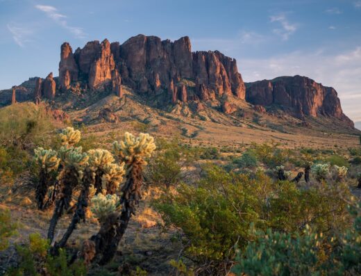
Premier Hiking Destination at The Flatiron
The Flatiron stands out as a top-tier hiking area near Apache Junction, AZ, known for its challenging terrain and rewarding vistas. With an impressive 4.9-star rating from numerous visitors, it delivers an exceptional outdoor adventure. Though review details are limited, the high ratings reflect the trail’s popularity among experienced hikers looking for a fulfilling climb and panoramic views of the surrounding landscape. This destination promises an unforgettable experience for those seeking a vigorous hike combined with the natural beauty of the Arizona desert.


Srivatsava Appalla
in the last weekMust do once if you are in AZ! Super hard! Views are godly!
Gordon
3 weeks agoThis is what Camelback wishes it was. The hike is equal part challenging, equal part fun. There's a ton of scrambling, but goodness me is it a ton of fun! Plus the view? Spectacular! Make sure you got water, it's the kind of hike that'll suck you dry. With all that being said, the Flatiron decides who gets to ascend, hopefully it chooses you!
高矩
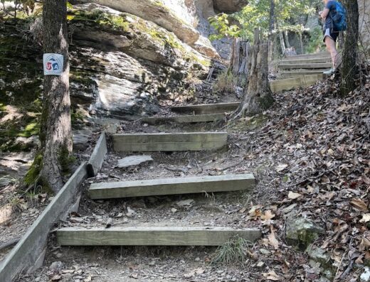
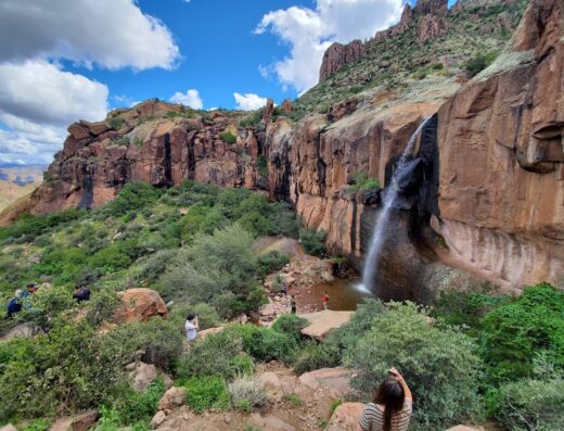
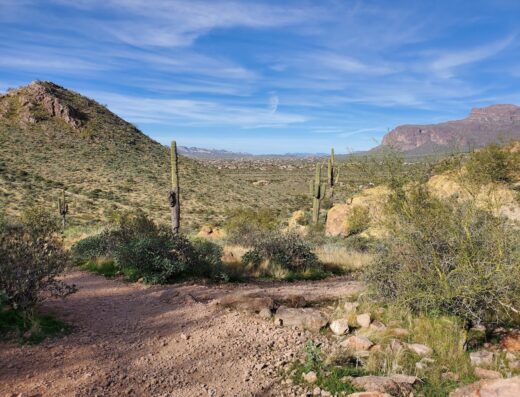
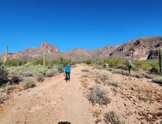
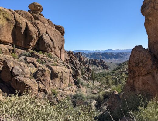
a month agoMount Flatiron, a popular hiking spot near Phoenix, Arizona, is one of Arizona's representative mountains. 1. The Mount Flatiron trail is located in the Supersonition Wilderness east of Phoenix, adjacent to Lost Dutchman State Park. The elevation of the summit (Flatiron) is approximately 1,500 meters (over 4,900 feet). The most common route to the summit is the "Siphon Draw Trail." It is a challenging trail with high difficulty, involving climbing steep rocky areas and inclines. The round trip is approximately 8-9 km, and the required time varies depending on fitness, but it is a demanding day hike of about 4-6 hours. 2. Arizona's mountain ranges (low mountains and mountain ranges): Arizona has many mountains, from low mountains ranging from canyons like the Grand Canyon and arid desert areas to lush, high mountains. The area around Phoenix, in particular, is a treasure trove of "low mountains." The Supersonition Range, which includes Mount Fratillon, is a mountain range characterized by its rugged, rocky terrain. Just a brief introduction: Mount Camelback, located between Phoenix and Scottsdale, is a famous low mountain resembling a camel's back. It's one of the most popular hikes near urban areas. Mount Piestois, also a very popular low mountain, is located within Phoenix. The summit offers panoramic views of the city. South Mountain is one of the world's largest municipal parks, with countless peaks and trails (for mountain biking and hiking). 3. Arizona's mountain peaks/areas: San Francisco Peaks, near Flagstaff. It's the highest mountain range in Arizona, with Humphreys Peak being the highest point, which becomes a ski resort in winter. The Chiricahua Mountains, located in the southeast, are volcanic mountains with distinctive rock formations. They are known as the Chiricahua National Monument. The Four Peaks, visible from Phoenix, are a distinctive mountain range (within the Maza Tsar Mountains) with four peaks, as its name suggests. Kit Peak is a mountain known for having an observatory. Matsudaira Mount Flatiron, a popular mountain climbing spot near Phoenix, Arizona, is one of Arizona's most representative mountains. 1. The Mount Flatiron Trail is located in the Supersonic Wilderness in east Phoenix, adjacent to Lost Dutchman State Park. The altitude of the mountaintop (flatillon) is approximately 1,500 meters (approximately over 4,900 feet). The most common route to the summit is the ``Siphon Draw Trail''. This is a challenging and thrilling trail that climbs steep rocks and steep slopes. This is a strenuous day hiking course that is approximately 8 to 9 km round trip and takes approximately 4 to 6 hours depending on your physical strength. 2.Range of Mountains in Arizona (Low Mountains/Mountains) Arizona has many mountains, ranging from canyons such as the Grand Canyon, dry desert areas, low mountains, and lush high mountains. In particular, the area around Phoenix is a treasure trove of low mountains. The Supersonic Mountains, to which Mount Flatiron belongs, are a mountain range characterized by rough rock surfaces. As an introduction, Camelback Mountain is a famous low mountain located in Phoenix and Scottsdale that resembles the shape of a camel's back. This is the most popular hike near the city. Mount Piestwa is another very popular low mountain located in Phoenix. You can see a panoramic view of the city from the top of the mountain. South Mountain is one of the largest municipal parks in the world, with countless mountain peaks and trails (mountain biking and hiking). 3. The mountain peak/area in Arizona is the San Francisco Peaks near Flagstaff. It is the highest mountain range in Arizona, and its highest peak is Humphreys Peak, which is used as a ski resort in the winter. The Chiricahua Mountains are a series of volcanic rocks lined with strangely shaped rocks in the southeast. It is known as the Chiricahua National Monument. The Four Peaks, as the name suggests, is a distinctive mountain range (within the Mazar Mountains) that can be seen from Phoenix and has four peaks. Kitt Peak is a mountain known for its observatory. Matsudaira
Johnny Li
a month agoWe tried to go up flatiron. The trial was steep and require going up steep and sometimes risky surfaces. Make sure shoes has good grips. It was harder than we imagined and as we reach the saddle where turning right is flatiron for the last stretch, the sun was going down and we decided to turn back. We logged about 9.25 miles and 10 hours. We rested a lot. Knowing this, I think it's better for us to camp at lost dutchman if we want to try to flatiron again, we need to plan for more time and be in better shape.
David Johnson
a month agoGreat hike. Can be busy on a weekend, but was pretty quiet on Friday morning. The upper trail is indeed difficult, but the views at the top are fantastic. Check out the park store!